First transcription efforts
In a previous blog post we described some initial digitization we did on a small sample of the data available. These trials allowed us to assess working speed, content and content quality of the INEAC archive. During this first pass we digitized a small booklet which described not only the protocol used in the meteorlogical measurements in the Congo Basin but also the geographic locations of the stations which were in service at the time of publication (1939).
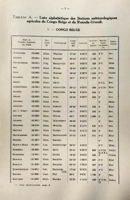 |
After digitizing these data we transcribed this first batch of data (only mapping the data for DR Congo). The data presented includes all stations (which at a minimum measured precipitation) and those which also include temperature measurements. However, the lack of temperature measurements did not necessarily mean that no other measurements were made. The existence of the station in 1939 does not guarantee it’s continuous operation or the lack of more recent data as many stations were added after this date.
As the COBECORE project has only a limited running time we will focus on those locations which combine both precipitation and temperature measurements (and all other observations made if they exist at the respective stations).
A static version of this map can be found using this permalink: http://cobecore.org/map.
BLOG
maps climate_data