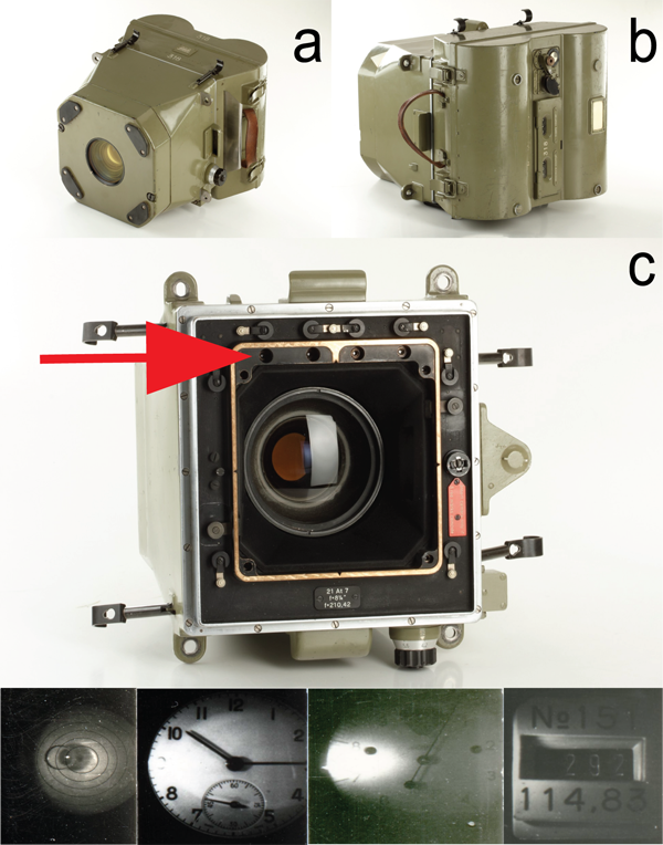
The Wild Heerbrugg RC5a aerial camera
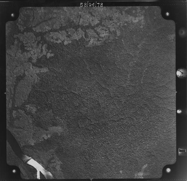
In previous blog posts we’ve shown our efforts to digitize old aerial photographs taken over the central Congo basin at the end of the 1950’s (e.g. Fig. 1). As the digitizing work is finished and the georeferencing of the data will start shortly it is always good to provide some context on how these images were taken and how this might affect post-processing. Here we provide a short summary on the camera used during the aerial campaigns and some of the additional data recorded on negatives.
 |
From meta-data we know that the camera used to acquire the images was a Wild Heerburgg RC5a (Fig. 2). The Heerbrugg Camera Company was founded in 1921 by Heinrich Wild. The company, at the time, was a major leader in terrestrial mapping, with the development of their “Autograph”. The first of such camera setups was produced in 1949 and developed for many years after. The camera setup is used as an accurate Aviograph stereoplotter with an Aviotar high-precision photogrammetric lens that was invented in 1948. Over time the company has merged with the now better known Leica Geosystems.
 |
In the setup the Autograph would ensure timely pictures with a precise (known) overlap (sidelap) between images. This sidelap together with flight parameters would allow post-processing, using stereographs, to create accurate topographic maps. During post-processing we will use this same information to constrain the generation of georeferenced maps.
BLOG
aerial photography history