Scanning aerial photographs completed
A couple of month ago the COBECORE team started to digitize aerial photographs from the 50’s, in order to provide a general context for the eco-physiological and climate data gathered by the team.
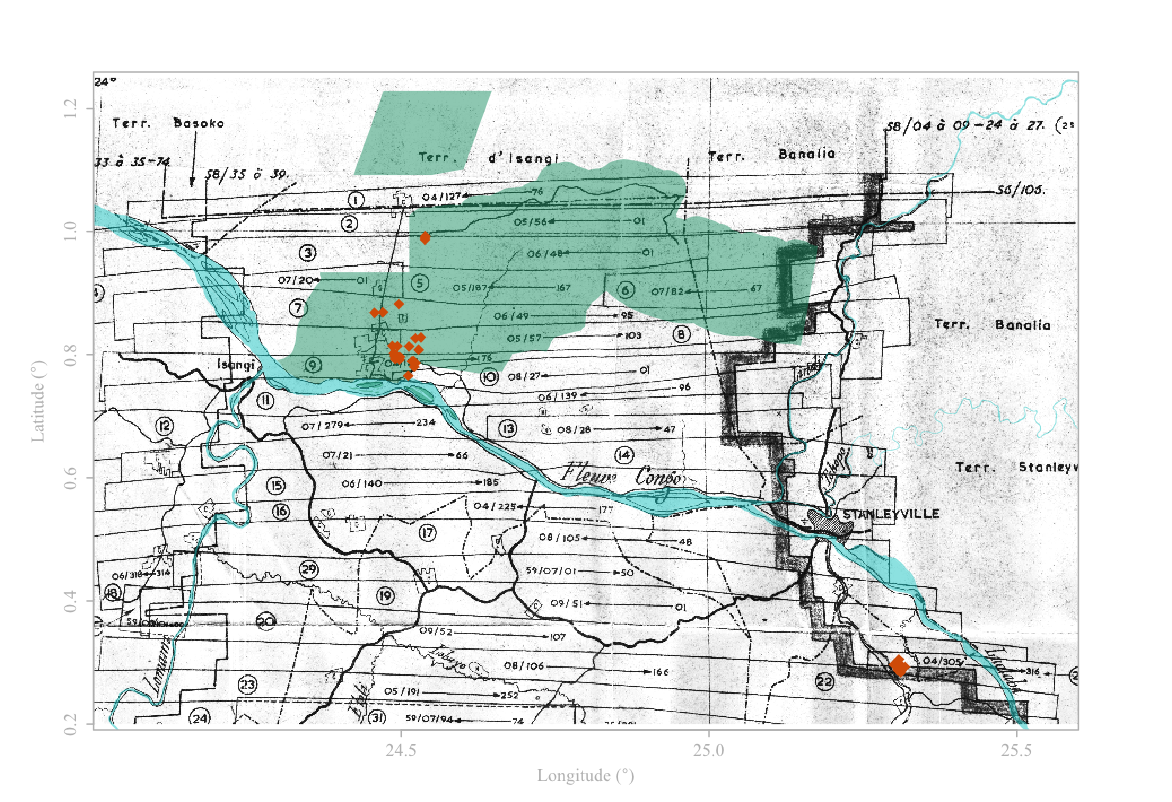
Now, we are happy to announce that the first milestone has been reached: all the pictures of the Yangambi reserve from 1958-1959 kept in the Royal Museum for Central Africa (RMCA) archives are now completely digitalised. This dataset features 403 aerial photographs, covering roughly 5 000 km2 of tropical forest. The pictures were scanned to a 2400 dpi resolution, for a total of 382 GB of data.
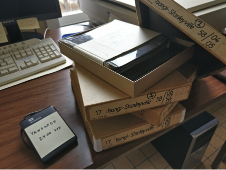 |
The next step in the valorisation of these images is to stitch them all together, using the overlap between each neighbouring pictures, in order to produce a full extent high resolution image of the Yangambi area. During their six decade of existence, 6 out of the original 409 pictures where lost, probably due to changes in managing administration and storage locations or data lending (10th flight path, pictures numbered 22 to 27). However, due to overlap of other flight paths this gap will most likely be filled in during the stitching process.
 |
BLOG
digitization remote_sensing aerial_photography