The importance of old aerial photography data
The history of earth observation from satellite platforms has it’s origin in espionage. From 1959 onward the US operated through it’s intelligence agency (CIA) the Corona missions. These missions were the first imaging satellites in operation, and were meant to spy on the Soviet Union.
 |
These satellites would take images on large format film as digital imaging technology was not advanced enough. These rolls of film would then be dropped to Earth to be intercepted in flight by a recovery plane. A first set of these old images were declassified in 1996 the most recent ones in 2013. These data not only provide an insight in the mapping operations of the CIA they also provide insight in land cover and land use change.
Due to the presence of uranium mines in the DR Congo the CIA probably had a keen interest in mapping DR Congo and surveilling infrastructure. Within this context Kisangani, as a major city, was mapped. The larger region also included the Yangambi research station and surrounding forests and plantations.
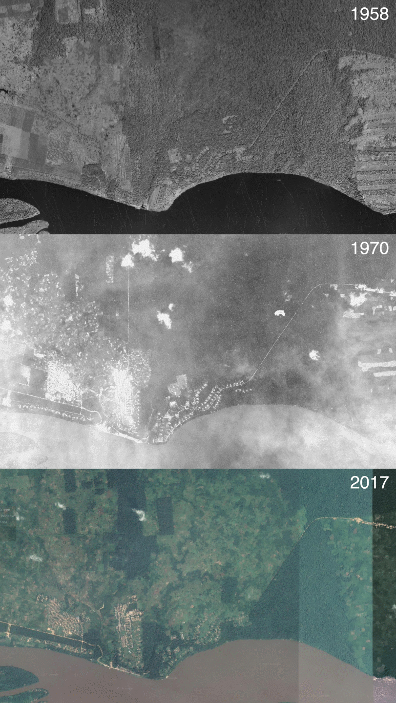
Above you see the whole large format film as recorded over the Yangambi research station by one of the Corona satellites (anno 1970) and purchased through the USGS earth explorer. Although this high resolution data exists (~2m resolution) cloud cover remains a problem for satellite remote sensing data. The low frequency at which images were taken, sometimes only once, limited the use of these images over tropical regions with persistent cloud cover. Although from a historical perspective these images are rather interesting they have only limited value for the proposed texture analysis as included in the COBECORE proposal. Meaning, limited structural properties can be derived due to extensive cloud coverage, this in contrast to the aerial photographs we are processing.
Below you see an animated gif cycling through the different data sources, from high resolution contemporary data, over the Corona data, to the very high resolution aerial photographs as acquired over Yangambi in 1958. It’s clear on how much better the quality of the aerial photographs is compared to this early satellite data. However, the Corona missions remain a rather amazing feat of engineering.
 |
BLOG
remote_sensing aerial_photography espionage
